
AER’s FloodScan service provides daily maps of large-scale, inland flooding from 1998 to the present based on satellite remote sensing technology.
 Features
- Regional Coverage: Coast-to-coast coverage for Africa, South America, North America (to 55°N latitude), and Asia-Australia (to 55°N latitude and 50°E longitude).
- High Resolution: ~90-meter resolution everywhere.
- Frequent Updates: Daily updates for the entire coverage area from automated, near real-time satellite data processing systems.
- Historical Reach: Daily record extending back to 1998.
- Consistency and Objectivity: Uses one algorithm for both near real-time and historical processing. No human-in-the-loop biases.
FloodScan monitors continent-sized areas for flooding from day and night satellite observations regardless of cloud conditions. Our algorithms combine the latest available data with prior measurements to produce best-estimate, coast-to-coast flood maps every day at ~90-m scale. FloodScan’s regional perspective and daily update cycle often makes it the first service to completely map large floods. Users can track changes in flood extent over time and get a picture of the maximum extent of multi-day floods. Backed by a 25+ year historical record, users can build custom applications and perform analytics with FloodScan data with the confidence that future products will be consistently derived using the same proven algorithms.
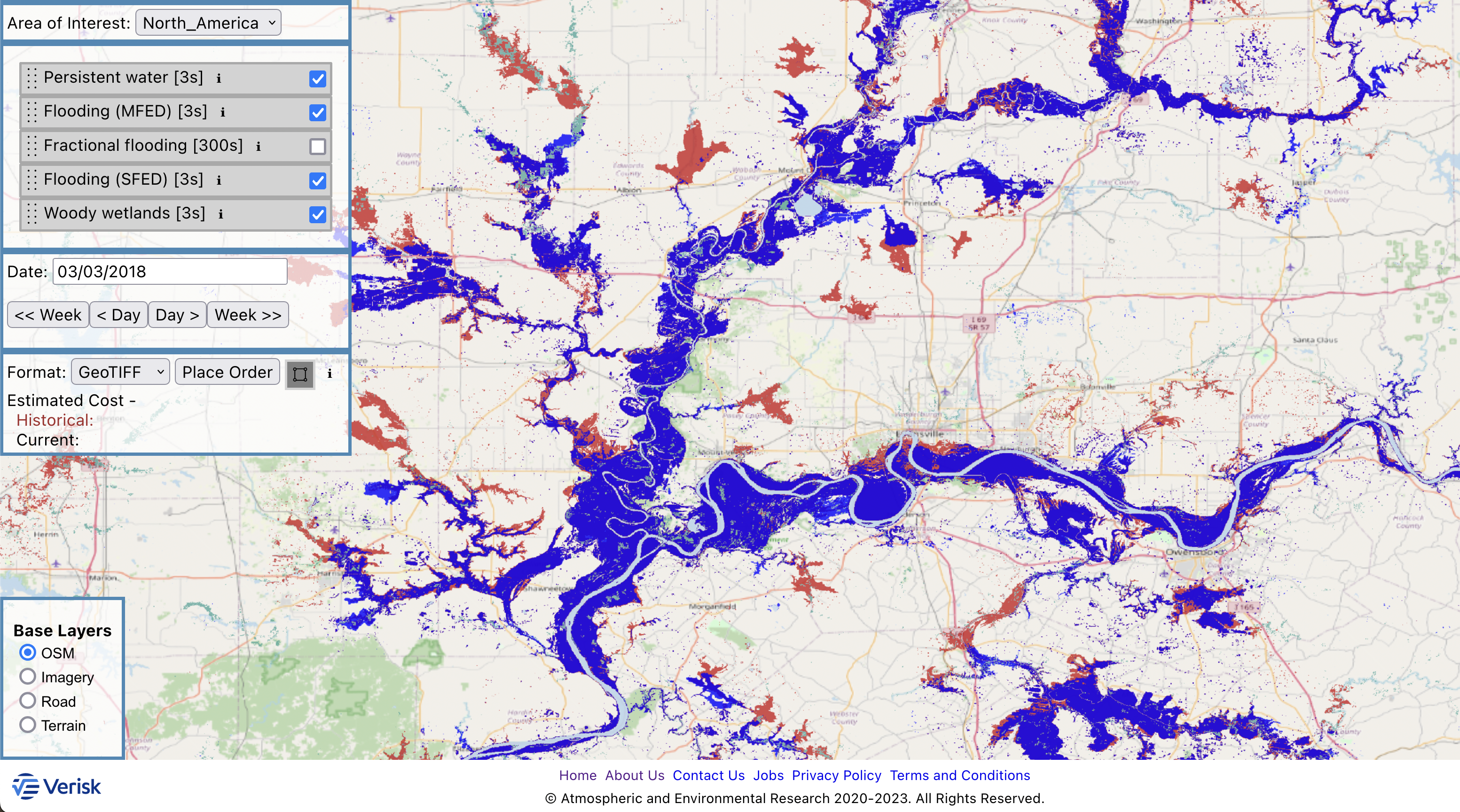
FloodScan Interactive Web Interface
Users can browse near real-time and historical FloodScan data through the FloodScan interactive web interface. Registration is free and requires only a valid e-mail address. The web interface carries the SFED, MFED, SFED-AREA, LWMASK, and WWMASK products (described below).
FloodScan Product Suite
FloodScan provides primary and secondary products designed to meet a variety of users’ needs. FloodScan’s primary data products—SFED and MFED—map large scale, inland river flooding well but are less likely to depict flooding in smaller floodplains and near coastlines. FloodScan’s secondary products—NDT-SFED and NDT-MFED—are designed to map flooding in areas missed by SFED and MFED for users able to manage higher false positive rates. FloodScan’s derivative data products include multi-day compositing, flood depth estimation, and area integration for ease of use and insights into flood severity. FloodScan custom data packages include all currently available data products, giving users the flexibility to use one or more products at their discretion. The FloodScan Data Users Guide includes guidance for selecting a product set appropriate for each application.
Primary Data Products
Product |
Details |
Description |
|
SFED |
|
Designed for flood monitoring applications that prioritize:
|
|
MFED |
|
Designed for disaster response applications that prioritize:
|
Secondary Data Products
Product |
Details |
Description |
|
NDT-SFED |
|
|
|
NDT-MFED |
|
Multi-Day and Area-Aggregate Data Products
Derived from MFED or SFED
Product |
Details |
Description |
|
ACC |
Accumulated flood extent over user-specified time period |
Combines primary/secondary products and masks into a single dataset for ease of use |
|
NDAYS |
Number of days flooded over user-specified time period |
Useful as an indicator of flood severity or detection confidence |
|
DEPTH |
Maximum flood water depth over user-specified time period |
Useful as an indicator of flood severity or detection confidence |
|
AREA |
Area-aggregate fractional flooding at ~10x10-km scale (daily) |
Use for regional/historical questions, e.g.:
|
Subscription Pricing
FloodScan subscriptions give users immediate access to the latest near real-time FloodScan data via Web Coverage Service (WCS) protocols. Subscriptions are priced at $25,000 per year. Contact Us for discounted pricing for researchers and non-profit institutions.
Bulk Order Pricing
Bulk orders for the full FloodScan historical record, 1998-present, are priced per region:
|
|
Bulk price |
|
North America |
$25,000 |
|
Africa |
$10,000 |
|
South America |
$10,000 |
|
Asia-Australia |
$30,000 |
|
Full Coverage |
$75,000 |
Bulk orders include all the products available through the web interface – SFED, MFED, SFED-AREA, LWMASK, and WWMASK – plus NDT-SFED, NDT-MFED, and MFED-AREA. Contact Us for discounted pricing for researchers and non-profit institutions.
Technical Documentation
- ARC Flood Extent Depiction Algorithm Performance Document
- ARC Flood Extent Depiction Algorithm Description Document
- AGU poster